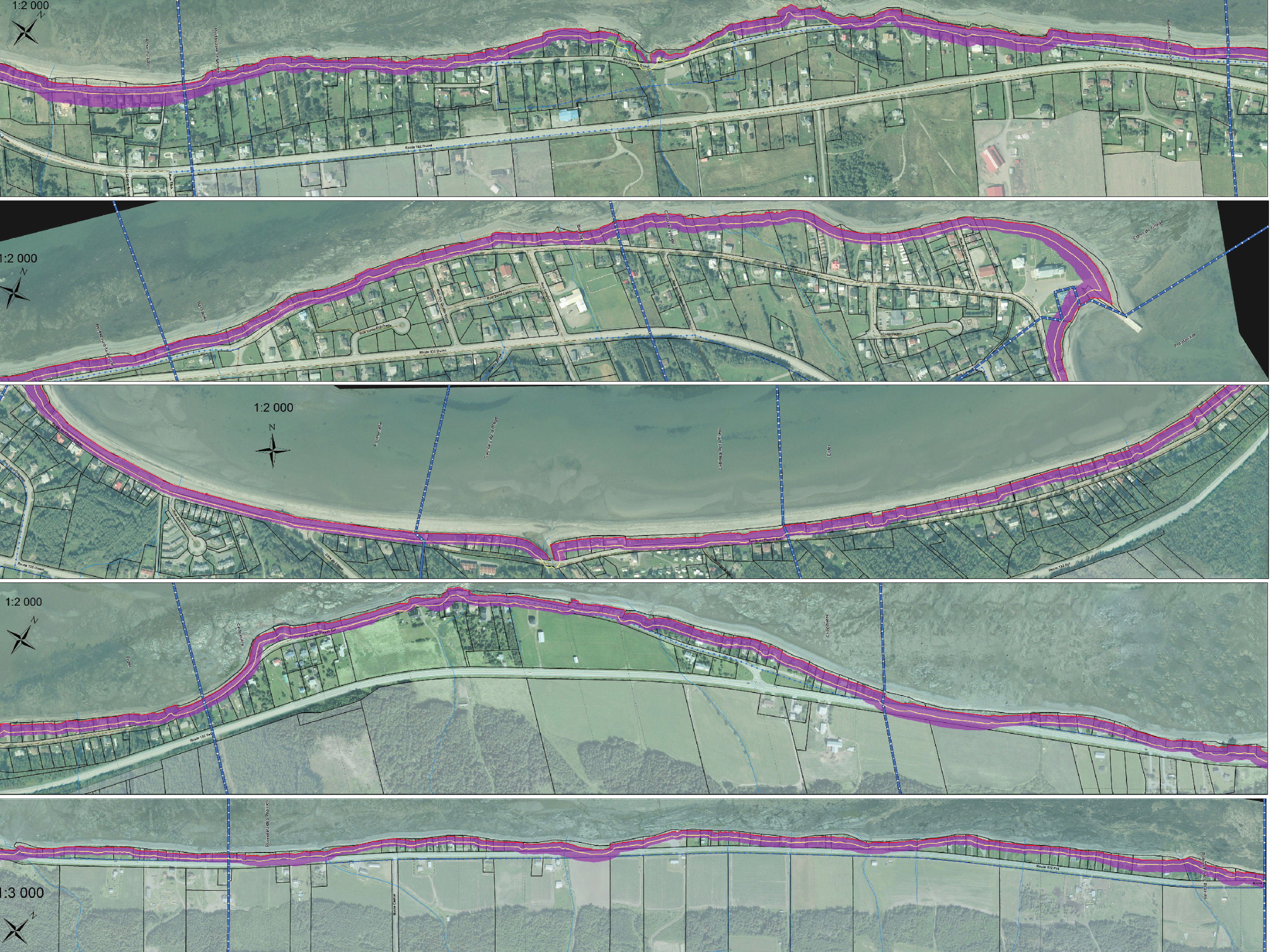
The menacing zone: it took almost seven years before the official map of risk was released, which overlaps existing development and future risk due to erosion along the shore. Homes in the purple zone are considered
“constrained,” which is also the title of the map.
To constrain is to exert force upon, and the impression
is that the river is exerting force on the shore. But
Route 132 is also constraining life, marginalizing lands
between infrastructure and encouraging and imaging
uncertainty. If the purple overlay is unsettled,
then it also traces the landscape of retreat.