The region is not only the northern threshold of the peninsula, it is the south shore of the St. Lawrence River, also known as Le Fleuve Saint Laurent in French, and Kaniatarowanenneh or Big Waterway in the Mohawk dialect of the Iroquoian language.
3
Jean-Philippe Guilbault, “La deuxième vie des maisons riveraines,” Récits numériques, Radio-Canada (15 June 2022);
Haudenosaunee people are commonly referred to as Iroquois or Six Nations. Haudenosaunee means “people of the longhouse,” which refers to a pre-contact gathering place for northern Iroquoian-speaking peoples. The Haudenosaunee Confederacy refers to the five member nations that live primarily in reserves (Canada) or reservations (United States), in the northern part of New York state, the Haudenosaunee consisted of the Seneca, Cayuga, Oneida, Onondaga, and Mohawk. See: haudenos
auneeconfederacy.com/who-we-are.
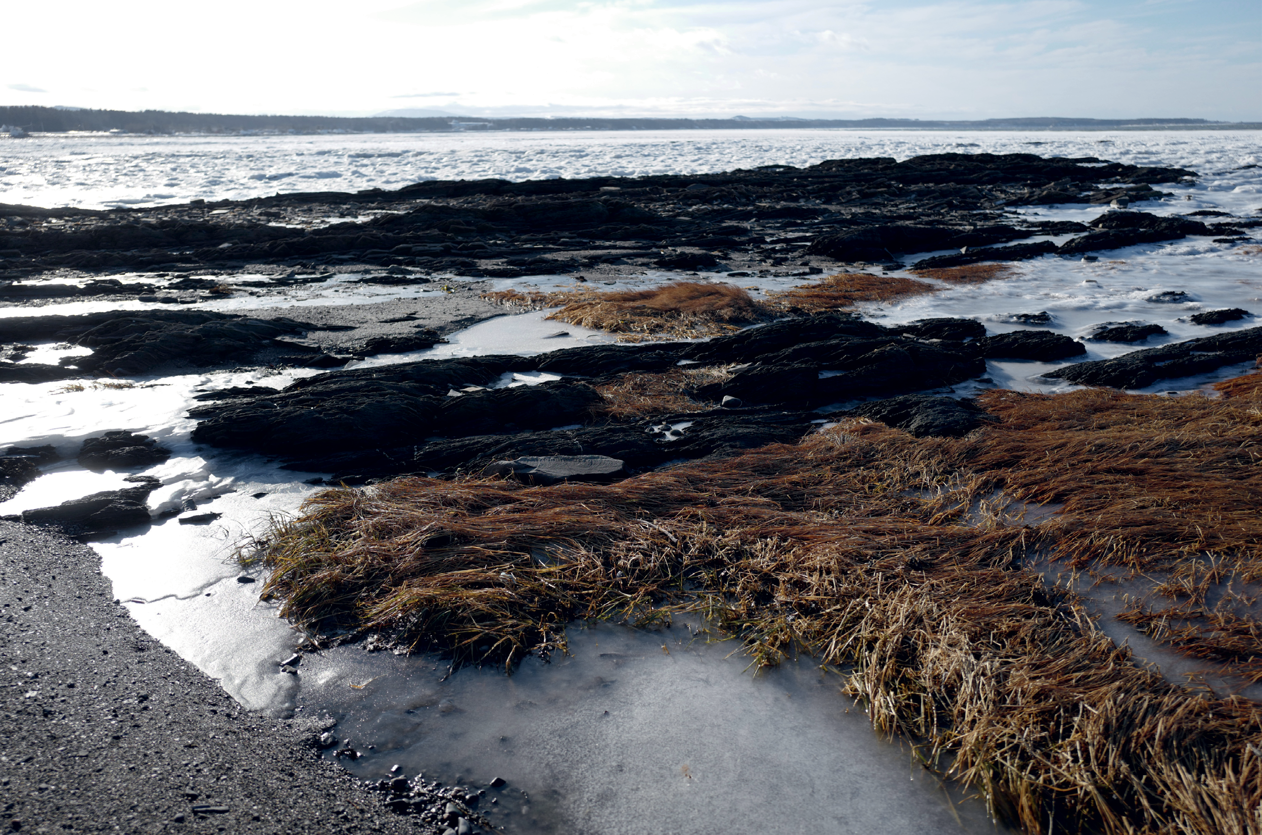
It is unusual for a river so large to be tidal, especially along its 3,000 kilometer course between the Great Lakes and the Atlantic Ocean. Big Waterway rearranges its own edges, and those who cannot control it are controlled by it. At once gulf, estuary, and river, it feels like a tectonic consequence, an agent of flushing, a mechanism of disintegration. Shores are read in variations between the narrow canals and locks that squeeze past cities, the rugged bays, and fjords along the fluvial sector that gapes at Québec City and begins to mingle with salt water. As it broadens, Big Waterway grows brackish, becoming an estuary where tidal flows bridge the rocky coasts of the North-shore [Côte-Nord] and the compensatory floodplains of the South-shore [Côte-Sud]. At Tadoussac, or Totouskak in the Innu language, Big Waterway completes its interweaving and becomes a saltwater river which brings an associated shift in marine life, including a significant playground for beluga whales. In this upper estuary, Big Waterway reaches five kilometers across before discharging into the Gulf and recharging the Atlantic Ocean. The only way across the Gaspésie Peninsula is along a narrow two-lane road numbered 132, the longest highway in Québec. The road is nicknamed the Navigator’s Route, perhaps because it guides vessels along Big Waterway, offering steady access and visibility to the shore. On land, Route 132 creates a divide between the smooth contours of low-lying farmland on one side and the rugged shores of the ever-widening river on the other. The divided scene reveals a landscape of sweeping views and a break between the rocky shore and the shallow floodplain soils. The recurring pattern produces a wild juxtaposition: the synthetic hum of the trucking industry and the wallop of wave action, geometric rows of maize and blurry thickets of wild rose, blunt winter storms and seasonal summer residents, tucked away towns, and small harbors. It makes sense that Gaspésie is derivative of a Mi’kmaq expression Gespeg, which roughly means “the place where land ends,” a reminder that the peninsula is formed by the northward extension of the Appalachian range. The land gives off the impression of pushing against the edge of the world.It is hard not to think of edges on an icy day in December, standing along the residential frontage of Route 132, where tarmac meets frozen lawns and freshly plowed driveways. Across the road, colorfully painted summer rentals are visible against the horizon, boarded up for the penetrating winter. Bright yellow, blue, and red colors are a useful reminder of the sandy seaside community, but summer memories feel trivial against the 127 kilometer per hour winds that howl through our gear. This place where land ends is also where water begins, and is not quiet or peaceful. It is a cacophony of elemental sound—blowing, whooshing, crashing, colliding wintery reverberations. Mariel and I found ourselves shouting at one another through periodic interference, as gusts spin snow around us. Looking back now, it is fair to say that the sensations of winter are not only brought on by cold but found in the veils of sound that travels across long distances in less populated parts of the world.
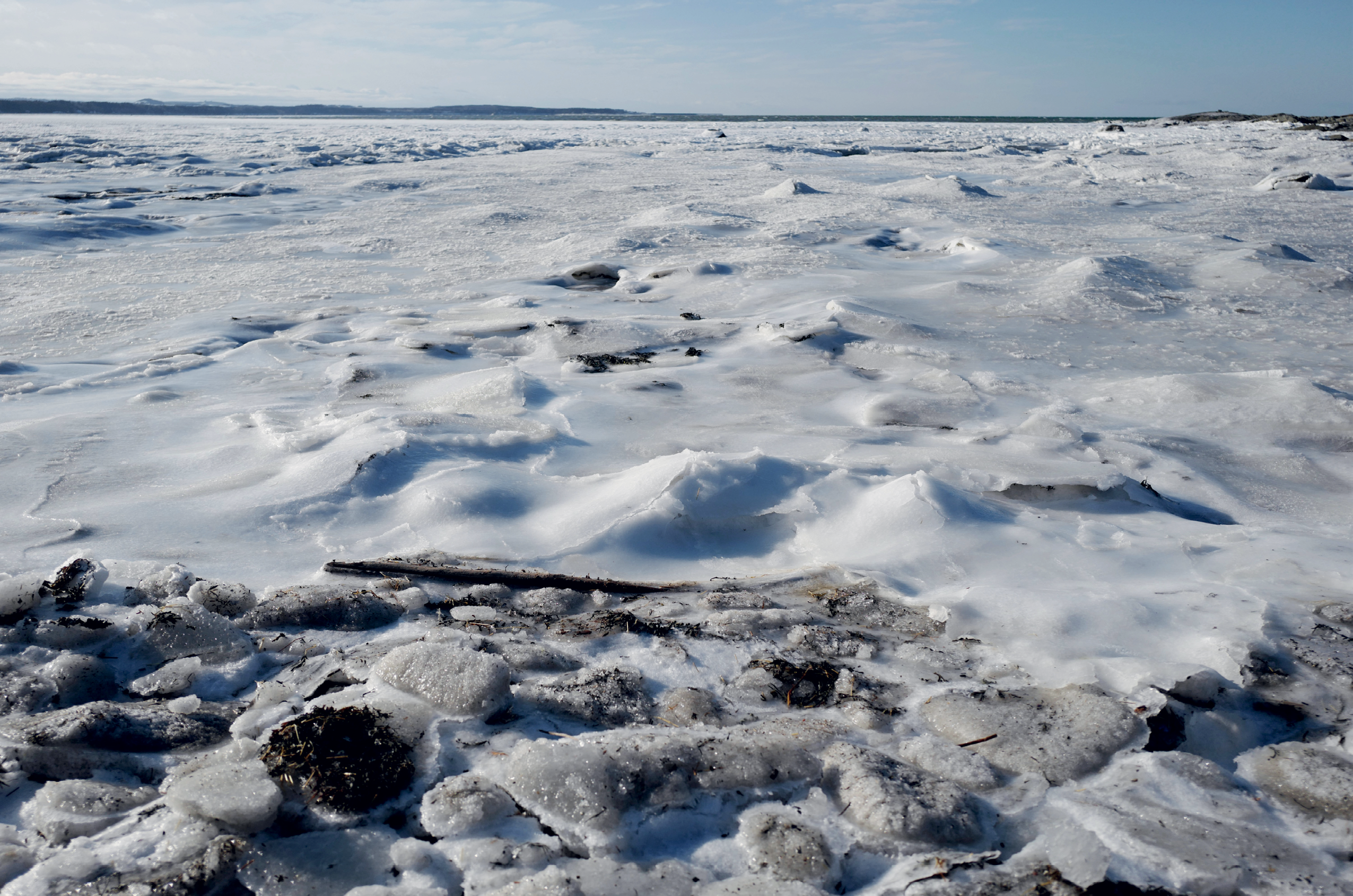
Although winter ecology is associated with the least productive months of the year, life is far from dormant across the thick ice floes of the Saint-Lawrence River. Microbial assemblages grow all year in the ice and at the ice–water interface, and vertical channels are formed where algae flourishes. Flora and fauna that associate with ice are called Sympagic organisms.
“If the term ‘Aboriginal People’ seems problematic, phrases such as ‘Native People’ or ‘Indigenous People’ are no clearer. ‘Native’ typically denotes a condition of birth. People are native to the culture, city, or nation of their birth, therefore anyone born in Canada is native Canadian. ‘Indigenous People’ is the phrase usually associated with international discussions and protocol agreements. Unfortunately, it is often lumped in with words that sound like cognates but are not; a quick glance at the dictionary reveals that ‘indigene’ and all things ‘indigenous’ are nestled too comfortably between ‘indigence’ and ‘indigent.’ ‘Indigenous People’ may quickly come to mean the impoverished people of the undeveloped world. As general categories go, neither is better or worse than the other. Like all generic phrases, they invariably disguise diversity for the sake of convenience.”
4
Alan D. McMillian and Eldon Yellowhorn, First Peoples in Canada (Vancouver: Douglas & McIntyre 2004).
— Alan D. McMillian and Eldon Yellowhorn,
First Peoples in Canada
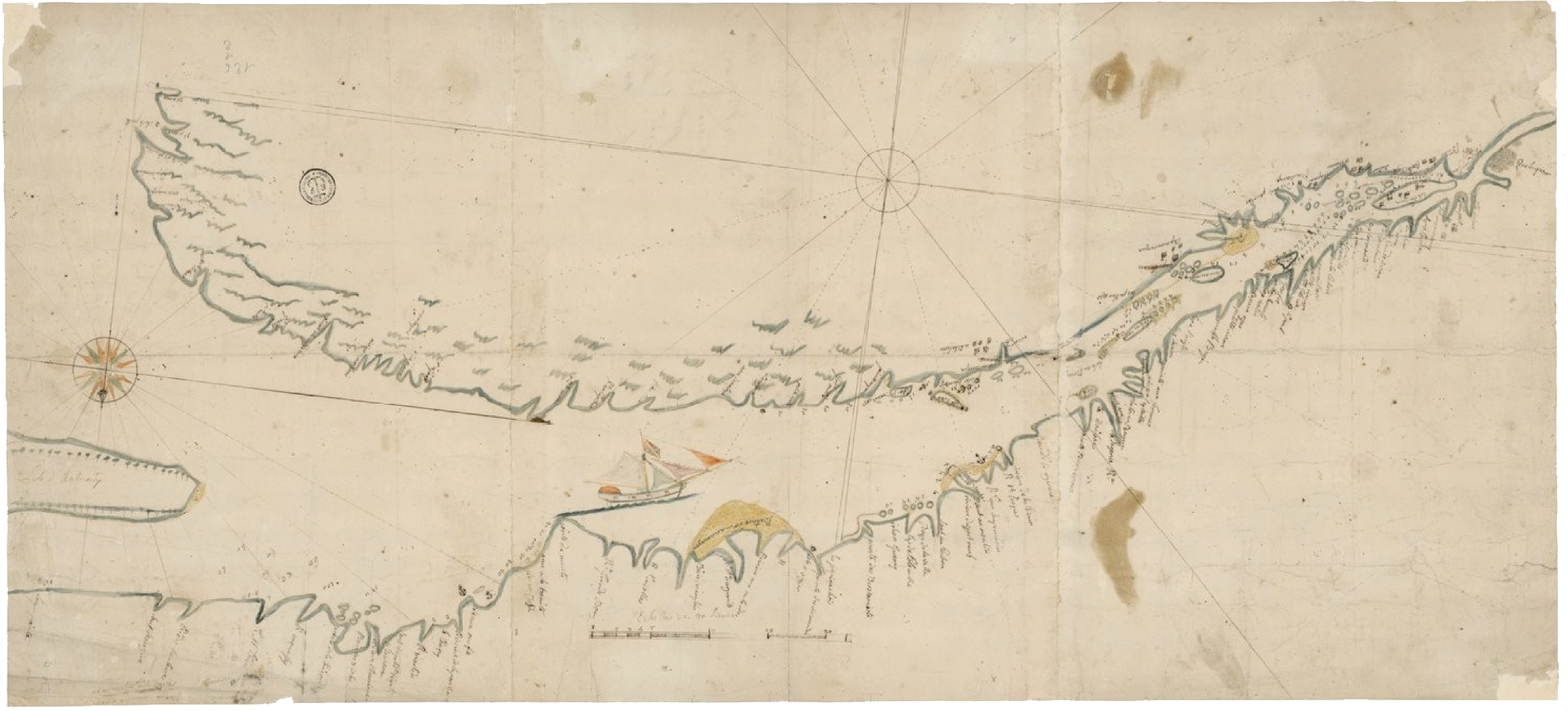
A 1828 survey map of the Gaspésie Peninsula helps explain the reach of European influence through the consequent nautical proficiency and cartographic accuracy, neither of which was particularly refined along the extents of Atlantic Canada. The subtle reportage of conquest was fraught by the freeze and thaw of seasons; the depth, salinity, and currents of Big Waterway were tough to chart, difficult to predict. Shorelines were magnificent but hard to reach from the water, interrupted by rocky cliffs, slowed by wide estuaries, and broadened by the vast gradations of periodic mud flats. To profit from land-based resources meant overcoming the lateral tidal flow, and Europeans were not practiced in the ways of tidal rivers. The map, like so many at the time, was drawn with complementary purposes; navigate the landscape by constructing infrastructure to expand nation-building. Expand nation-building by extracting and trading resources.
A rupture twenty-five kilometers deep beneath the Nazca plate, produced the earthquake, triggering a tsunami that traveled along the
fault at tectonic junctions. The magnitudinous waves spread beneath the coast until making landfall along the shores between Constitución and Concepción. Magnitude is relative power, and its measurement takes into account the energy released at the source. By comparison, intensity is the strength of the shaking produced by the magnitude.