
The Maule River estuary outfalls at Constitución, one of the hardest hit communities following the tsunami in 2010. Extreme pulses of inundation are common to estuarine environments where marine sand meets river silt. At present, many estuaries along the Chilean coast are infilled by coastal concretization that intervenes between marine and terrestrial realms.
The wave action following an earthquake brought silty inundation, erosion, and deposition to the estuarine coast, a disturbance that is neither unprecedented nor particularly unique. The lineage of estuary formation across time is described by paleo-geological
analysis which confirms that the southwest coast of
Chile is a remarkably active area on
Above the Pines
2
The state of historic tsunami forests gained attention following the 2011 Tohoku tsunami in Sendai. See for instance: Satoshi Kusumoto et al., “Reduction Effect of Tsunami Sediment Transport by a Coastal Forest; Numerical Simulation of the 2011 Tohoku Tsunami on the Sendai Plain, Japan” Sedimentary Geology 407 (2020).
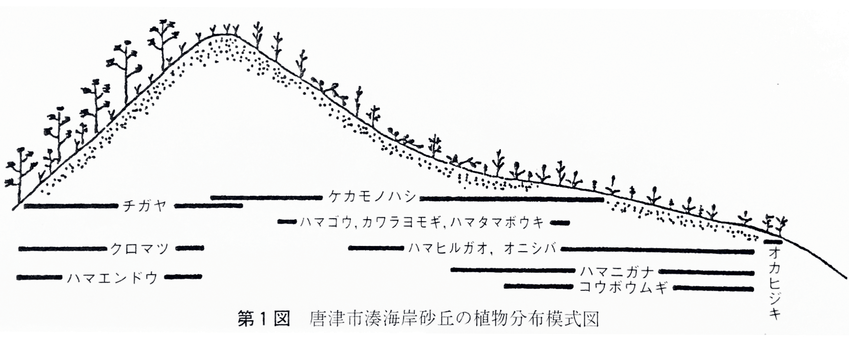
Regional risks were more likely found in the tumult and mobility of salty particulates, the typical mingling of land and water.Each protection forest was initiated to either reduce erosion, stabilize dunes, attenuate waves, limit tsunami damage, dampen salt laden wind, and prevent tidal surge, or some combination of multiple hazards. Since Karatsu was primarily an agricultural village, Nijinomatsubara was imagined by the lord of Karatsu Doman as a windbreak to shield fields from wind, sand, and salt. Yet, the breadth and limits of each planting plan did not simply depend upon the demands of the market, or the littoral morphology—it relied upon the traditions and rituals of adjacent villages. Restoration was not an embedded practice, rather, planting and its associations with growth and life were celebrated. The artificial forest is valued for its age and connections to past generations, revealing the social ties embedded in developing landscape design over the long-term.
This contemporary drawing details the necessity of restoration across sand-dune communities, while ink drawings from the nineteenth century (overleaf) cultivate the meaning of a planted forest. Both type of depictions are acts of the imagination—brought to life in human, geological, and botanical time.
A rupture twenty-five kilometers deep beneath the Nazca plate, produced the earthquake, triggering a tsunami that traveled along the
fault at tectonic junctions. The magnitudinous waves spread beneath the coast until making landfall along the shores between Constitución and Concepción. Magnitude is relative power, and its measurement takes into account the energy released at the source. By comparison, intensity is the strength of the shaking produced by the magnitude.